Central Texas Weather Page
[This page is maintained by meteorologist Lon Curtis.]

Saturday,
June 7, 6:50am CDT


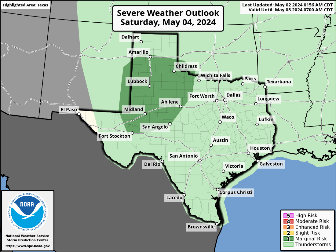
The graphic above is available directly from the Storm Prediction Center (SPC) website.
From the SPC website, you can access many other graphics by going to this link:
Click here
to go to the SPC website
_________________________________________________________________________________
Forecast Discussion
PENDING


[Most graphics on this and other pages found on this website are typically updated more frequently. Most of those graphics will have a date/time stamp.]


Do you want to learn more about tornadoes and tornado history? Follow this link to Tornado Talk ... Link


Cloud-to-Ground Lightning Strikes Detected Over The Past Two Hours


Past Two Hours Looping Lightning Detection
(Updates Every Five Minutes = Time Displayed is PDT = Add Two Hours for CDT)


Regional Outlook Graphics (focused on Texas) ... (L to R): Day-1, Day-2, Day-3 ... Click on any image to enlarge it ...


Forecast Discussion
Pending


IMPORTANT LINKS
                                                                                                                                          Note: The links connecting to other sections listed below are not yet complete.
Weather radar from sites in Texas and elsewhere
Weather Hazards Central Texas Skycams
Upper Air Analyses:

a) Data tables on
charts posted at 'mandatory' levels from near the surface upward to near the stratosphere

b) Analyzed maps for conditions at mandatory levels (925mb, 850mb, 700 mb, 500 mb, 300mb & 250mb)

Severe Storm Outlooks

Other Weather Hazards
Texas Drought Monitor
Local NWSFO text products including forecasts, watches, & warnings, etc/


Tropical Weather Page for current & developing storms WPC forecast products & CPC outlook products Local Climate and Station Precipitation Records


Central Texas Lake Levels updated = May 11th


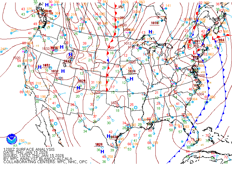
Current Latest National Weather Map


Short-Range National Forecast Maps


L to R: Day-1, Day-2 and Day-3 Weather Forecast Maps from the NOAA Weather Prediction Center
[Click on any image to enlarge it; reload this page to update images]

 Hazardous Weather Outlooks
From the NWS Forecast Offices responsible for Central Texas counties.
Fort Worth (FWD) / Austin-San Antonio (EWX) / Houston-Galveston (HGX) / San Angelo (SJT)
(Click on the three-letter identifier to read the latest HWO product)
To most of us, the 4th of July means a day off from work spent with family and friends, perhaps going to a parade, having a barbeque or watching fireworks. But Independence Day signifies so much more. It not only honors the birthday of our country, but the adoption of the Declaration of Independence which tells us that we are all "created equal."


Seasonal Drought Monitor (left) and Outdoor Burn Bans (right)

(Click on either image for a larger version)
=================================================================================================================================
Tornado Outbreaks Spawned by Tropical Cyclones at Landfall
The subject of tornadoes produced by landfalling tropical cyclones (tropical storms and hurricanes) has been a fascination (and a research interest) of mine for years. After working through several iterations of the research, the final manuscript was submitted to one of the professional journals of the American Meteorological Society. The A.M.S. journals, like most scientific publications, subject proposed articles to a formal peer review process. Following peer review, my manuscript was accepted, and published in the April, 2004 issue of Weather and Forecasting. Here is a link to the article.

[Overall general content was last updated on 11/07/2023.]

If you have comments or suggestions, email me at tloncurtis@gmail.com

This page created with Mozilla SeaMonkey